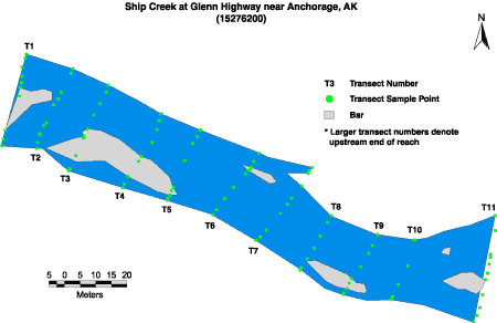
Ship Creek at Glenn Highway near Anchorage
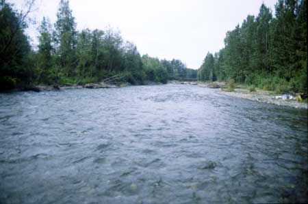
Ship Creek at Glenn Highway, looking downstream towards footbridge from upper end of reach.
Image Map
Site Information
This site is part of the Urban Gradient Synoptic. There is one reach (C) in this site. The reach length is approximately 150 meters.
LOCATION - Lat 61°14`20", long 149°41`32" in SW1/4 SW1/4 SE1/4 sec. 6, T. 13 N., R. 2 W. (Anchorage A-8 quad), Municipality of Anchorage, 1000 ft downstream from bridge, 0.3 mi upstream from Fort Richardson power plant dam, and 6.2 mi east of Anchorage.
DRAINAGE AREA - 103.0 sq. mi.