Deshka River near Willow
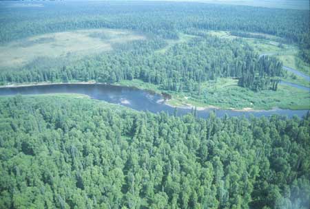
Aerial view of NAWQA ecology reach at Deshka River near Talkeetna looking east. Downstream is to the right.
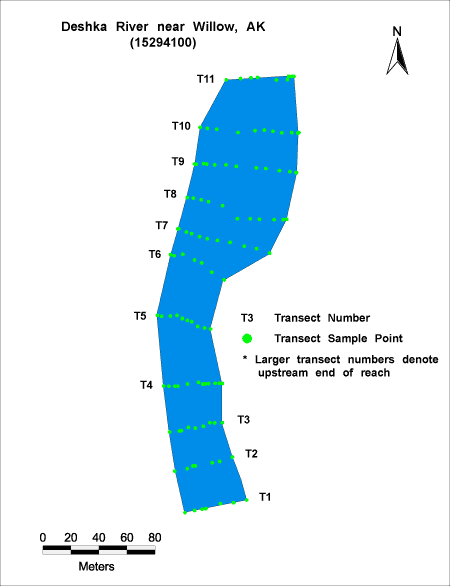
Habitat Photo Image Map
Click on a transect number to see habitat photos for that transect.
Site Information
NAWQA REACH
This site is part of NAWQA's Basic Fixed Site Network. There is one reach (C) at this site. The reach is approximately 300 meters in length, and is located about 1/2 mile upstream of the gage site.
GAGING STATION
LOCATION.--Lat 61deg.46min.05sec., long 150deg.20min.13sec., in SW1/4 NE1/4 sec.3, T.19 N., R.6 W., in Mantanuska-Susitna Borough (Tyonek D-1 quad), Hydrologic Unit 19020505, on left bank, 0.2 mi upstream from unnamed tributary, 1.1 mi downstream from unnamed tributary, 7.9 mi upstream from mouth, and 10 mi west of Willow.
DRAINAGE AREA.--592 mi2.
WATER-DISCHARGE RECORDS
PERIOD OF RECORD.--October 1978 to September 1986, October 1998 to September 1999.
REVISED RECORDS.--WRD AK-83-1: 1980.
GAGE.--Water-stage recorder. Elevation of gage is 80 ft. above sea level, from topographic map.
REMARKS.--Records good, except May 4 to July 12 which are fair and estimated daily discharges which are poor. Goes satellite telemetry at station.
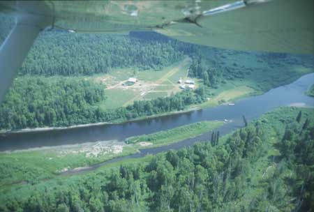
Aerial view of gage site, downstream is to the right. Gage is located on left bank across from downstream end of vegetated bar.