South Fork Campbell Creek near Anchorage
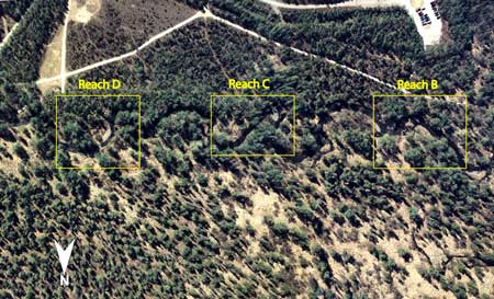
Aerial photo of South Fork Campbell Creek near Anchorage, looking south. Reach C is the primary reach in this multiple reach site. Reach B is farthest downstream.
Click on a reach to see information relating to that reach.
Site Information
NAWQA REACH
This site is part of NAWQA's Basic Fixed Site Network. There are 3 reaches within the site - D (upstream most), C, and B (downstream most). C reach is the gage reach. Each reach is approximately 150 meters long and separated from the adjacent reaches by 150 meters. This is also a Cook Inlet NAWQA synoptic reach.
GAGING STATION
LOCATION.--Lat 61deg.10min.02sec., long 149deg.46min.14sec., in NW1/4 sec. 2, T.12 N., R.3 W. (Anchorage A-8 quad), Municipality of Anchorage, 0.2 mi downstream from bridge on dog-mushing trail leading to Campbell Airstrip, 2.0 mi upstream from North Fork Campbell Creek, and 5.5 mi southeast of Anchorage.
DRAINAGE AREA.--30.4 mi2.
PERIOD OF RECORD.--July 1947 to September 1971, October 1, 1998 to current year.
GAGE.--Water-stage recorder. Altitude of gage is 260 ft from topographic map. Prior to Aug. 20, 1952, water-stage recorder at site 0.2 mi upstream at different datum. Aug. 20, 1952 to July 15, 1958, water-stage recorder at site 70 ft downstream from previous site at different datum. Oct. 1, 1998 water-stage recorder at same site and different datum as previous site.
REMARKS.--Records good, except for estimated daily discharges, which are poor.
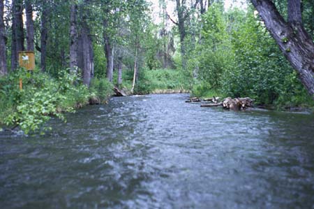
Water-stage recorder at Reach C.