
Full extent – Return map to a full view of the entire state
Welcome to the help guide for the Geology of Alaska Map Viewer. This viewer provides access to the GIS datasets and associated databases published with the USGS Geologic Map of Alaska1, and the USGS Alaska Resource Data File.
The geology available through this viewer is provided at two different levels of detail. The “detailed” geology is shown by default at map startup. These layers provide access to the full versions of the GIS datasets and are intended for larger scale use down to 1:250,000. The “generalized” geology is the geology shown on the printed state geologic map. It is a simplified dataset derived from the detailed geology and is intended for smaller scale use only. See the metadata and readme files on the Geologic Map of Alaska website for more information on the detailed and generalized geology.
The Alaska Resource Data File provides descriptions of mines, prospects, and occurrences across the state. The records in the database are generally for metallic mineral commodities only but also may include certain high value industrial minerals such as barite and rare earth elements. Common industrial minerals such as sand and gravel, crushed stone, and limestone and energy minerals such as peat, coal, oil and gas are not included in this database. The descriptions in the database were compiled using published literature, unpublished reports and data from various sources including the U.S. Bureau of Mines, the U.S. Geological Survey, and industry.
1Wilson, F.H., Hults, C.P., Mull, C.G., and Karl, S.M., comps., 2015, Geologic map of Alaska: U.S. Geological Survey Scientific Investigations Map 3340, 197 p., 2 sheets, scale 1:1,584,000, http://dx.doi.org/10.3133/sim3340.
Full extent – Return map to a full view of the entire state

Previous extent – Go back to previous view of map

Next extent – Return to view of map before clicking previous extent

Zoom in – Make the map appear larger or nearer

Zoom out – Make the map appear smaller or further

Zoom to selected polygon
The mouse can also be used to change the map view. Roll the mouse wheel forward or double click to zoom in. Roll the mouse wheel back to zoom out. Dragging the mouse will pan the map. Holding down the shift key while dragging the mouse will draw a box to zoom to.
Place names for geographic features within Alaska can be located using the search box in the upper left of the map. As the name is entered a list of suggested matches will appear beneath the box. Selecting a feature name will zoom to the location and mark it with a symbol and its name.

The table of contents controls which layers are visible on the map. It contains two tabs: one for the geology layers and another for the basemap layers.

Table of Contents – Open or close the table of contents window
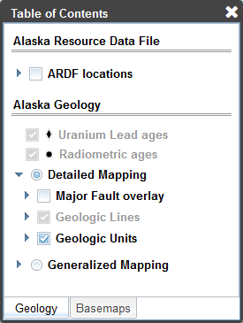
All of the geologic data layers in the map are listed on this tab. Use the buttons next to the Detailed Geology and Generalized Geology groups to alternate between the two levels of geologic detail. Layers from both groups cannot be displayed simultaneously. If a layer is grayed out it will not be visible until the map has been zoomed in further. Layers with an arrow next to the check box can be expanded to show a legend of all the unique feature types in the layer. Check or uncheck the box next to the layer name to show or hide the features on the map.
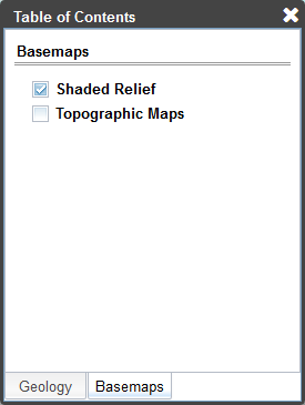
All of the basemap layers in the map are listed on this tab. Basemap layers are available at any zoom level. Check or uncheck the box next to the layer name to show or hide the base layer on the map. Shaded relief is from the USGS National Elevation Dataset and has a resolution of approximately 50 meters. Topographic maps are from the USGS 1:250,000 scale quadrangle series.
There are several ways to view the information contained in the different geology layers.
Hovering the cursor for a brief moment over a geologic unit from either the detailed or generalized layers will display the unit label, unit name, and age in the lower left corner of the map. This area is also where the latitude and longitude coordinates (datum NAD83) of the cursor location are shown along with the name of the overlying 1:250,000 scale quadrangle. This example shows a unit from the detailed geology in the Anchorage quadrangle.

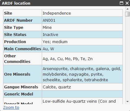
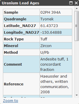
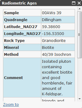
Clicking on features in the ARDF locations, Uranium Lead ages, Radiometric ages, or Major Faults layers will open a popup window at the feature location listing its attributes. There is a maximize button on the popup window that can be used to expand its size for easier reading of long text entries. Major faults will be highlighted in yellow when selected.
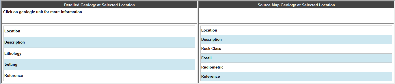
When the map viewer first loads there are two blank information tables below the map. These tables provide attributes from the GIS polygons and associated databases when a geologic unit is selected (mouse click). This area can be resized or hidden using the tab to increase the area available for displaying the map. When hidden using the tab it is not possible to select new polygons.
Clicking on one of the detailed geologic units will fill in the tables as shown below. The selected polygon will be highlighted on the screen by a yellow outline. The left hand section gives the unit information from the published state geologic map. The right hand section gives the unit information at the same location for the source geologic map, from which the state map was compiled.
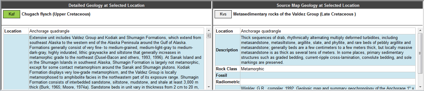
Detailed Geology Table
Location - Name of quadrangle containing the selected unit
Description - Full description of the unit from the state geologic map pamphlet
Lithology - Lists the different types of lithologies assigned to the unit, the form of the unit, and the unit rank. Rank has four possible values that indicate how much of the map unit the lithology represents. The values are Major, meaning greater than or equal to 33 percent; Minor, between 10 and 33 percent; Incidental, less than 10 percent; and Indeterminate, major (Wilson and others, 2015).
Setting - Describes the type of environment the unit was formed in
Reference - Full citation for the state geologic map
Source Map Table
Location - Name of quadrangle containing the selected unit
Description - Abbreviated description of the unit from the original source map
Rock Class - Possible entries include Unconsolidated, Sedimentary, Igneous, Metamorphic, or Tectonite
Fossil - Lists fossils found in the unit
Radiometric - Lists radiometric age dates for the unit
Reference - Full citation for the source map
Clicking on one of the generalized geologic units will fill in the tables as shown below. The selected polygon will be highlighted on the screen by a yellow outline. The left hand section gives the unit information from the printed state geologic map. Source unit information for the generalized units is not applicable so the right hand section will remain empty.
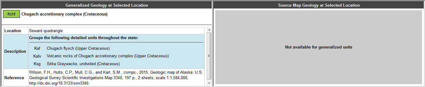
Generalized Geology Table
Location - Name of quadrangle containing the selected unit
Description - Lists the unit(s) from the detailed geology that were combined into the generalized unit
Reference - Full citation for the state geologic map