Factsheets
U.S. Geological Survey Arctic ecosystem assessments (3/2021)
Arctic regions of Alaska are important for cultural and economic sustainability and host a wide variety of wildlife species, many of which are of conservation and management interest to the U.S. Department of the Interior. The USGS and collaborators provide information about Arctic ecosystems that are used by Arctic residents, management agencies, and industry.
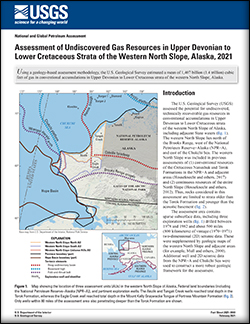
Assessment of Undiscovered Gas Resources in Upper Devonian to Lower Cretaceous Strata of the Western North Slope, Alaska, 2021 (2/2021)
Using a geology-based assessment methodology, the U.S. Geological Survey estimated a mean of 1,407 billion (1.4 trillion) cubic feet of gas in conventional accumulations in Upper Devonian to Lower Cretaceous strata of the western North Slope, Alaska.
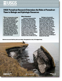
USGS Permafrost Research Determines the Risks of Permafrost Thaw to Biologic and Hydrologic Resources (1/2021)
The U.S. Geological Survey (USGS), in collaboration with university, Federal, Tribal, and independent partners, conducts fundamental research on the distribution, vulnerability, and importance of permafrost in arctic and boreal ecosystems. Scientists, land managers, and policy makers use USGS data to help make decisions for development, wildlife habitat, and other needs. Native villages and cities can forecast landscape change and where soils are vulnerable to thaw with more certainty. The scientific community can use USGS data to develop scenarios of future permafrost change.
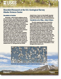
Shorebird Research at the U.S. Geological Survey Alaska Science Center (11/2020)
Shorebirds-which include sandpipers, plovers, and oystercatchers-are perhaps best known by their presence on sandy beaches, running along the water's edge while they probe for food. The focus of shorebird research at the U.S. Geological Survey Alaska Science Center is to help identify important breeding and migratory sites, and to investigate the causes of the declines in many shorebird populations.
Remote sensing of river flow in Alaska - New technology to improve safety and expand coverage of USGS streamgaging (5/2019)
Alaska rivers are home to rare and important ecosystems and are used for recreation, hydropower generation, commercial fishing, and transportation. River flow measurements are essential for wise and safe development and use of Alaska rivers.
Geospatial analysis identifies critical mineral-resource potential in Alaska (3/2017)
The USGS and the Alaska Division of Geological & Geophysical Surveys have developed a new geospatial tool that integrates and analyzes publicly available databases of geologic information and estimates the mineral-resource potential for critical minerals, which was recently used to evaluate Alaska.
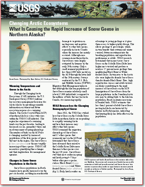
Changing Arctic ecosystems—What is causing the rapid increase of Snow Geese in northern Alaska? (9/2015)
The Arctic Coastal Plain (ACP) of northern Alaska is a key study area within the USGS CAE initiative. This region has experienced a warming trend over the past decades, leading to decreased sea ice, permafrost thaw, and an advancement of spring phenology. The number of birds on the ACP also is changing, marked by increased populations of the four species of geese that nest in the region. The Snow Goose (Chen caerulescens) is the most rapidly increasing of these species. USGS CAE research is quantifying these changes and their implications for management agencies.
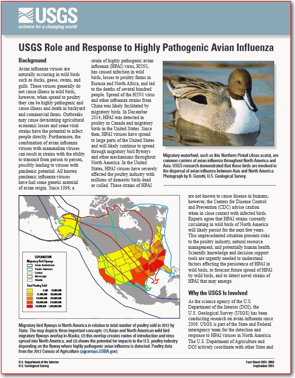
USGS role and response to highly pathogenic avian influenza (9/2015)
Avian influenza viruses are naturally occurring in wild birds such as ducks, geese, swans, and gulls. As the science agency of the U.S. Department of the Interior (DOI), the U.S. Geological Survey (USGS) has been conducting research on avian influenza since 2006.
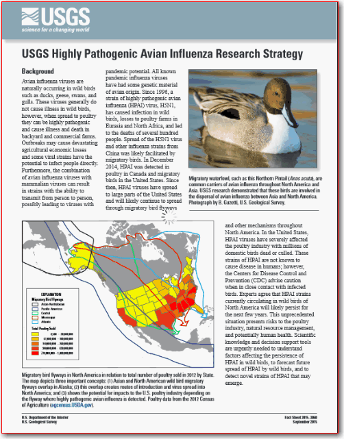
USGS highly pathogenic avian influenza research strategy (9/2015)
The USGS conducts research on avian influenza at multiple science centers across the nation and has amassed substantial national and international expertise investigating this disease. Scientists are defining the role of migratory birds in viral spread, characterizing genetics of viruses in wild birds, determining water conditions affecting survival of the virus in wetlands, and describing stages of infection in migratory birds.

USGS Arctic Science Strategy 2015-2020 (7/2015)
The Arctic science portfolio of the U.S. Geological Survey (USGS) and its response to climate-related changes focuses on landscape-scale ecosystem and natural resource issues and provides scientific underpinning for understanding the physical processes that shape the Arctic. The science conducted by the USGS informs the Nation's resource management policies and improves the stewardship of the Arctic Region.

Changing Arctic Ecosystems - Updated forecast: Reducing carbon dioxide (CO2) emissions required to improve polar bear outlook (6/2015)
The Arctic is warming faster than other regions of the world due to the loss of snow and ice, which increases the amount of solar energy absorbed by the region. The most visible consequence has been the rapid decline in sea ice over the last 3 decades - a decline projected to bring long ice-free summers if greenhouse gas (GHG) emissions are not significantly reduced. The polar bear (Ursus maritimus) depends on sea ice over the biologically productive continental shelves of the Arctic Ocean as a platform for hunting seals.

Mapping traditional place names along the Koyukuk River - Koyukuk, Huslia, and Hughes, Western Interior Alaska (11/2014)
Koyukon Athabascan peoples have settled along the Koyukuk River in Western Interior Alaska for thousands of years using the surrounding landscape for subsistence and cultural resources. However, recent changes in climate, technology, resource availability, and way of life have affected land-use patterns in the region, as well as use of the Denaakk'e (Koyukon) language. The current Koyukon population is about 2,300, and about 150 still speak the language (the youngest of whom are in their fifties). In addition, Elders, important keepers of both language and traditional subsistence-use areas, are aging, and opportunities to record their knowledge are diminishing.

Changing Arctic Ecosystems – Resilience of caribou to climatic shifts in the Arctic (10/2014)
The U.S. Geological Survey (USGS) Changing Arctic Ecosystems (CAE) initiative strives to inform key resource management decisions for Arctic Alaska by providing scientific information and forecasts for current and future ecosystem response to a warming climate. This region has experienced a warming trend over the past 60 years, yet the rate of change has been varied across the North Slope, leading scientists to question the future response and resilience of wildlife populations, such as caribou (Rangifer tarandus), that rely on tundra habitats for forage.

Changing Arctic Ecosystems - Ecology of loons in a changing Arctic (9/2014)
The U.S. Geological Survey (USGS) Changing Arctic Ecosystems (CAE) initiative informs key resource management decisions for Arctic Alaska by providing scientific information on current and future ecosystem response to a changing climate. Research by the USGS examines how breeding loons use the Arctic lake ecosystem and the capacity of loons to adapt to future landscape change.

Changing Arctic Ecosystems - Sea ice decline, permafrost thaw, and benefits for geese (8/2014)
Through the Changing Arctic Ecosystems (CAE) initiative, the U.S. Geological Survey (USGS) strives to inform resource management decisions for Arctic Alaska by providing scientific information on current and future ecosystem response to a warming climate. Saltwater tolerant plants are now thriving in these areas and this appears to be a positive outcome for geese in the Arctic.

Lithium - For harnessing renewable energy (4/2014)
Lithium, which has the chemical symbol Li and an atomic number of 3, is the first metal in the periodic table. Lithium has many uses, the most prominent being in batteries for cell phones, laptops, and electric and hybrid vehicles.

Changing Arctic Ecosystems - The role of ecosystem changes across the Boreal-Arctic transition zone on the distribution and abundance of wildlife populations (7/2013)
Through the Changing Arctic Ecosystems research initiative, the USGS strives to inform key resource management decisions by better understanding how wildlife populations of special interest to the Department of the Interior are responding to rapid physical changes in the Arctic. The initiative includes several research themes, including one focused on the Boreal-Arctic transition zone that evaluates (1) how the distribution, abundance, and community structure of breeding birds are related to climate-driven habitat conditions; (2) how rapidly the distributions of birds and their habitats are changing in this transition zone; and (3) how avian recruitment and survival are affected by climate and climate-driven habitat conditions. Results from these studies will be used to forecast which avian species, communities, habitats, and core geographic areas are likely to be most vulnerable to projected climate changes. In a new fact sheet published this week, the USGS highlights the research being conducted within the Boreal-Arctic transition zone.

Relationships between Health of Alaska Native Communities and Our Environment: Phase I—Exploring and Communicating (7/2013)
Alaska Natives depend on local natural resources for nutritional and, for many, spiritual health. As a result, public health in Alaska is strongly influenced by the relationship between people and their surrounding physical, chemical, and biological environments. Alaska is vast with diverse wildlife and plant communities that are valued as subsistence foods. These resources are supported by equally diverse ecosystems and their underpinning landforms and geologies. The U.S. Geological Survey is attempting to integrate physical, chemical, and biological information to better describe current (2013) environments and project scenarios for the future. Integrating ecological data into the public health dialogue is challenging for the more than 280 rural communities of Alaska. This fact sheet reviews a recent USGS effort, the Geographic Information System Native Health Project, to better incorporate scientific information into such dialogue.

Wildlife Disease and Environmental Health in Alaska (5/2013)
Wildlife and environmental health research at the USGS Alaska Science Center focuses on emerging wildlife diseases, movement and transmission of pathogens between continents and within Alaska, and the impacts of disease to wildlife populations. Information from this research will inform decision-making by wildlife management and human health agencies.

Changing Arctic Ecosystems - Measuring and forecasting the response of Alaska's terrestrial ecosystem to a warming climate (12/2012)
USGS Changing Arctic Ecosystems Initiative—New Fact Sheet Provides Update on Measuring and Forecasting the Response of Alaska's Terrestrial Ecosystem to a Warming Climate: Through the Changing Arctic Ecosystems (CAE) initiative, the USGS strives to inform key resource management decisions by better understanding how wildlife populations of special interest to the Department of the Interior are responding to rapid physical changes in the Arctic. The CAE initiative includes several research themes, including one focused on the Arctic terrestrial ecosystem and a range of focal wildlife species dependent on that environment. USGS has published a new Fact Sheet to highlight on-going field and laboratory research, integrative modeling framework, and new technologies being used to inform the overall CAE initiative.

Changing Arctic Ecosystems - Polar bear and walrus response to the rapid decline in Arctic sea ice (11/2012)
Through the Changing Arctic Ecosystems (CAE) initiative, the USGS strives to inform key resource management decisions by better understanding how wildlife populations of special interest to the Department of the Interior are responding to rapid physical changes in the Arctic. The CAE initiative includes a research theme focused on the marine ecosystem and effects of recent declines in sea ice on the polar bear and walrus. USGS has published a Fact Sheet to highlight the integrative modeling framework, new technologies being developed and early findings of this research theme.

Climatic Changes and Effect on Wild Sheep Habitat (4/2012)
Wild sheep are sensitive to environmental change and may be an effective indicator species of climate change in arctic and high mountain ecosystems. To understand the effects of climatic changes on Dall sheep habitat, U.S. Geological Survey scientists have been studying selected areas in Alaska since 2007. The research focus is on forage quality, nutrient levels, and changes resulting from warming or cooling climate trends. Preliminary results indicate significant changes in Dall sheep diet accompanying vegetation changes and upslope retreat of glaciers.

Changing Arctic Ecosystems - Research to understand and project changes in marine and terrestrial ecosystems of the Arctic (1/2012)
USGS recently published a new fact sheet entitled "Changing Arctic Ecosystems—Research to Understand and Project Changes in Marine and Terrestrial Ecosystems of the Arctic." Ecosystems and their wildlife communities are not static; they change and evolve over time due to numerous intrinsic and extrinsic factors. Through the new initiative Changing Arctic Ecosystems (CAE) the USGS strives to understand the potential suite of wildlife population responses to these physical changes to inform key resource management decisions such as those related to the Endangered Species Act, and provide unique insights into how Arctic ecosystems are responding under new stressors. The CAE initiative includes three major research themes including Marine Ecosystems, The Arctic Coastal Plans, and Boreal-Arctic Transiting Zone that span Arctic ice-dominated ecosystems and that are structured to identify and understand the linkages between physical processes, ecosystems, and wildlife populations.

The Alaska Geochemical Database: v. 1.0-Geologic Materials (10/2011)
The Alaska Geochemical Database (AGDB) is a new, comprehensive compilation of geologic, spatial, descriptive, mineralogical, and analytical geochemical data for samples collected in Alaska and surrounding waters by the U.S. Geological Survey (USGS) from 1962 to 2009.

Coastal Ecosystem Responses to Influences from Land and Sea Coastal and Ocean Science (10/2010)
Sea otters and the nearshore ecosystems they inhabit are the focus of a new multidisciplinary study by scientists with the USGS and several international, academic, and government collaborators. These ecosystems face unprecedented challenges, with threats arising from the adjacent oceans and lands. The Coastal Ecosystem Responses to Influences from Land and Sea project will investigate the many interacting variables that influence the health of coastal ecosystems along the Northeast Pacific shore.
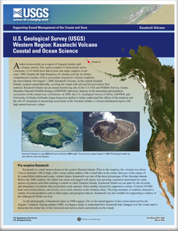
Kasatochi Volcano Coastal and Ocean Science (5/2010)
On August 7, 2008, Kasatochi Volcano, in the central Aleutian Islands, erupted catastrophically, covering the island with ash and hot pyroclastic flow material. In 2009, the U.S. Geological Survey (USGS), AMNWR, and University of Alaska Fairbanks began long-term studies to better understand the effects of the eruption and the role of volcanism in structuring ecosystems in the Aleutian Islands, a volcano-dominated region with high natural resource values.
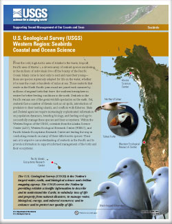
Seabirds Coastal and Ocean Science (7/2009)
From the cold, high Arctic area of Alaska to the warm, tropical Pacific area of Hawai'i, a diverse array of seabird species numbering in the millions of individuals live off the bounty of the Pacific Ocean.
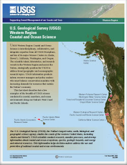
Coastal and Ocean Science (7/2009)
USGS Western Region Coastal and Ocean Science is interdisciplinary, collaborative, and integrates expertise from all USGS Disciplines, and ten of its major Science Centers, in Alaska, Hawai`i, California, Washington, and Oregon. This fact sheet describes but a few examples of the breadth of USGS science conducted in coastal, nearshore, and ocean environments along our Nation's West Coast and Pacific Islands.
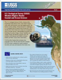
Western region: Alaska coastal and ocean science (7/2009)
USGS has three Regions that encompass nine geographic Areas. This fact sheet describes examples of USGS science conducted in coastal, nearshore terrestrial, and ocean environments in the Alaska Area.

Fifty-Year Record of Glacier Change Reveals Shifting Climate in the Pacific Northwest and Alaska, USA (6/2009)
Fifty years of U.S. Geological Survey (USGS) research on glacier change shows recent dramatic shrinkage of glaciers in three climatic regions of the United States. These long periods of record provide clues to the climate shifts that may be driving glacier change.

Pacific walrus response to Arctic sea ice losses (5/2008)
Sea ice plays an important role in the life of the Pacific walrus (Odobenus rosmarus divergens). U.S. Geological Survey (USGS) scientists are seeking to understand how losses of sea ice during summer over important foraging grounds in the Chukchi Sea will affect walruses.
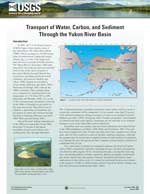
Transport of Water, Carbon, and Sediment Through the Yukon River Basin (1/2008)
In 2001, the U.S. Geological Survey (USGS) began a water-quality study of the Yukon River. The Yukon River Basin (YRB), which encompasses 330,000 square miles in northwestern Canada and central Alaska, is one of the largest and most diverse ecosystems in North America.

Alaska Science Center (3/2007)
The mission of the Alaska Science Center is to provide objective and timely data, information, and research findings about the earth and its flora and fauna to Federal, State, and local resource managers and the public to support sound decisions regarding natural resources, natural hazards, and ecosystems in Alaska and circumpolar regions.

Ground-water in the Anchorage Area, Alaska - Meeting the challenges of ground-water sustainability (12/2006)
Ground water is an important component of Anchorage's water supply. The sustainability of Anchorage's ground-water resources challenges stakeholders to develop a comprehensive water-resources management strategy.

A Century of Retreat at Portage Glacier, South-Central Alaska (11/2006)
The Portage Glacier, in south-central Alaska, is viewed by thousands of visitors annually who come to the U.S. Forest Service Begich, Boggs Visitor Center located on the road system between Anchorage and Whittier, Alaska. During the past century, the terminus of the glacier has retreated nearly 5 kilometers to its present location.

Floods on the Kenai Peninsula, Alaska, October and November 2002 (3/2004)
Record-setting precipitation and unusually warm temperatures produced widespread flooding in south-central Alaska in the fall of 2002. The unusual weather patterns persisted in the region for more than two months. On the Kenai Peninsula, heaviest rainfall and most severe flooding occurred October 22-24, and November 23, 2002. Flooding was most severe on the western part of the peninsula, especially between Ninilchik and Homer.

Hubbard Glacier, Alaska: Growing and advancing in spite of global climate change and the 1986 and 2002 Russell Lake outburst floods (1/2003)
Hubbard Glacier, the largest calving glacier on the North American Continent (25 percent larger than Rhode Island), advanced across the entrance to 35-mile-long Russell Fiord during June 2002, temporarily turning it into a lake.

Distribution of arsenic in water and streambed sediments, Cook Inlet basin, Alaska (9/2001)
The Cook Inlet Basin encompasses 39,325 square miles in south-central Alaska. Abundant mineral resources, recent glaciation, and volcanic activity contribute to the widespread distribution of arsenic in the environment. More than half of Alaska's population reside in the basin, mostly in the Anchorage area. However, rapid growth is occurring in the Matanuska-Susitna and Kenai Peninsula Boroughs to the north and south of Anchorage.

Historically active volcanoes in Alaska, a quick reference (9/2000)
More than 40 active volcanoes occur in Alaska. This report summarizes historical data on those volcanoes, using information drawn from the more thorough and comprehensive U.S. Geological Survey (USGS) Open-File Report 98-582, Catalog of the Historically Active Volcanoes of Alaska.