Alaska Science Center


Southern Beaufort Sea Polar Bear (1985-2016) GPS Tracking Maps and Data Visualizations

Return to USGS ASC Wildlife Tracking Collection >> S. Beaufort Sea Polar Bear (1985-2016) GPS Data

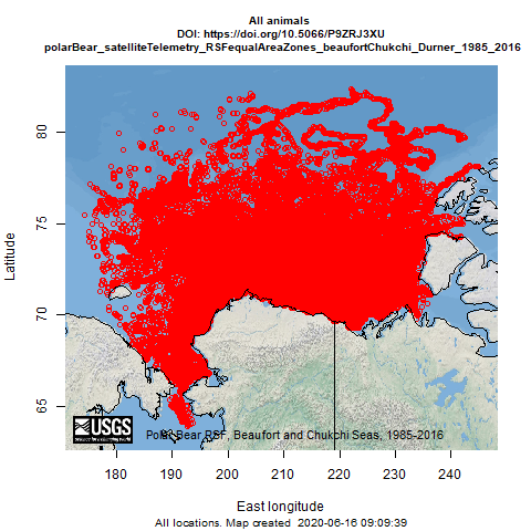
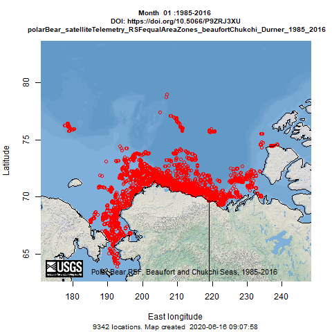
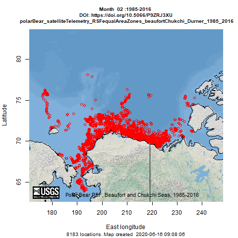
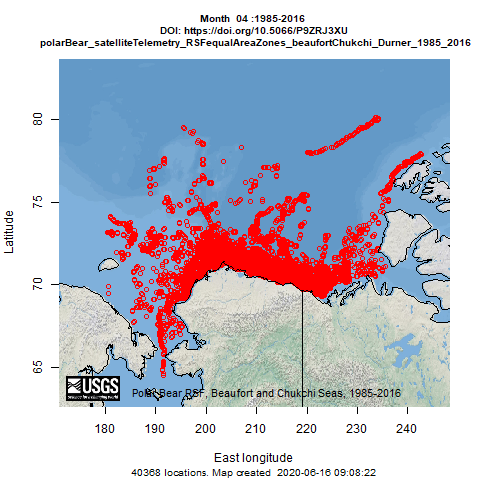
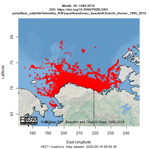
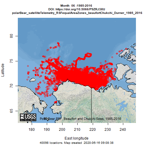
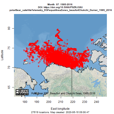
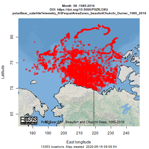
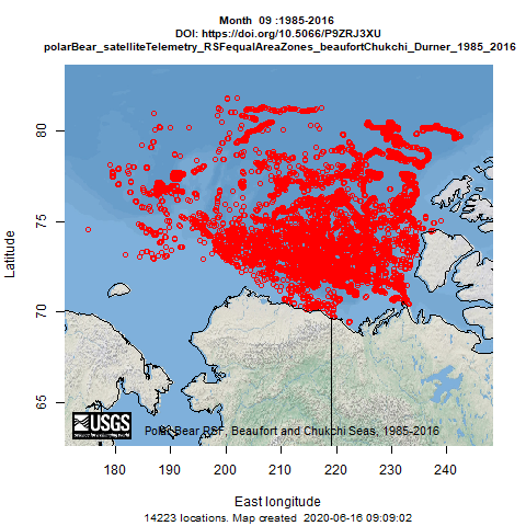
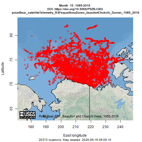
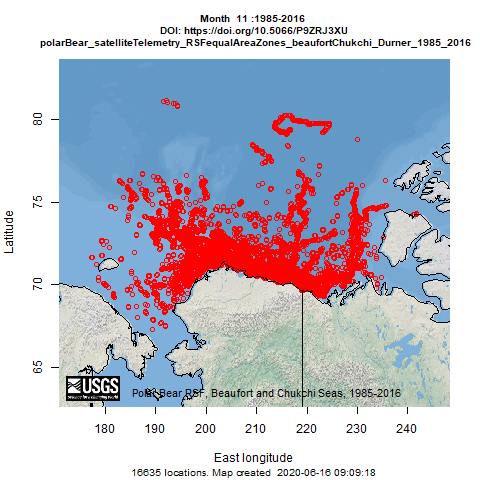
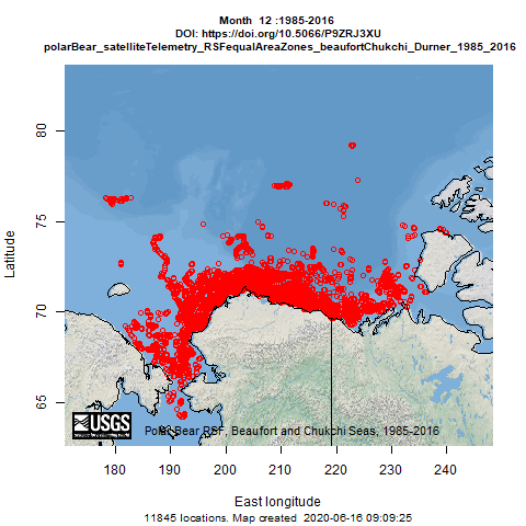
Available here are data from satellite radio-collared adult female polar bears captured in the southern Beaufort Sea (1985-2016). These data were used for assessing the regional, seasonal and decadal efficacy of retrospective polar bear resource selection functions (RSF) developed for the Arctic basin and its peripheral seas. These data are not reported with individual animal IDs through more than one season, so visualizations are pooled by month.

Note: These maps serve only as a depiction of the geographic content of the specific data provided and may be inappropriate for inferences and interpretation outside the intent of the original study. For example, maps may portray only certain ages, sexes, limited numbers of animals or variable tracking duration and start times that may limit inference for other questions. Users are advised to read the publication(s) and data set metadata associated with these maps to understand appropriate use and data limitations.

All animals

Telemetry map for all Southern Beaufort Sea Polar Bear (1985-2016) GPS Tracking Maps and Data Visualizations species
Static map | KMZ - Visualization

Months

01

Tracking map for species 01
Static map | Interactive map | KML - Visualization

02

Tracking map for species 02
Static map | Interactive map | KML - Visualization

03

Tracking map for species 03
Static map | Interactive map | KML - Visualization

04

Tracking map for species 04
Static map | Interactive map | KML - Visualization

05

Tracking map for species 05
Static map | Interactive map | KML - Visualization

06

Tracking map for species 06
Static map | Interactive map | KML - Visualization

07

Tracking map for species 07
Static map | Interactive map | KML - Visualization

08

Tracking map for species 08
Static map | Interactive map | KML - Visualization

09

Tracking map for species 09
Static map | Interactive map | KML - Visualization

10

Tracking map for species 10
Static map | Interactive map | KML - Visualization

11

Tracking map for species 11
Static map | Interactive map | KML - Visualization

12

Tracking map for species 12
Static map | Interactive map | KML - Visualization